France's fourth heatwave differs in scope and duration from earlier extreme events
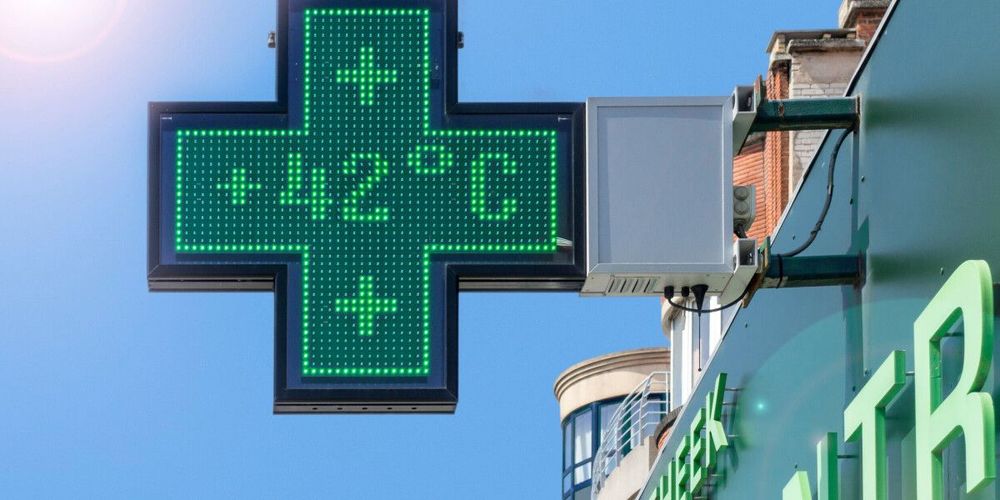
France entered its fourth heatwave of 2026 on July 29, with temperatures climbing to 42°C in the south-west and exceeding 35°C across central and eastern regions. However, meteorologists emphasise this event will diverge significantly from the prolonged and deadly heatwaves that struck earlier this year.
Météo France has placed 16 departments on orange heatwave alerts, including Gironde and Landes—sites of recent major wildfires—as well as eastern regions. The alert system uses a four-tier structure: green (vigilance), yellow, orange, and red. An orange alert indicates a heatwave with health risks to the entire exposed population lasting three consecutive days and nights, whilst a red alert signifies an extreme event exceptional in duration, intensity and geographic extent.
Contrasting patterns
Today's national average temperature is forecast to reach approximately 28°C, around 6°C above seasonal norms but below peak readings during June and early July. Those earlier heatwaves created a 'heat dome' effect, where warm air masses settled over France for extended periods, trapping radiation and preventing cooler air from entering the atmosphere. The result was relentless day and night-time temperature climbs that persisted for days.
June's heatwave proved particularly severe. Daily high temperatures averaged 36.9°C across France, shattering the previous June record set in 2022 by 2.4°C. On June 24, France recorded its hottest day on record. The two-and-a-half week event from June 12-29 caused more than 2,700 heat-related deaths, with daily mortality rates rising from fewer than 100 to almost 300 on the hottest days of June 24 and 25. At the peak, 90 departments were under orange alert covering 91% of the population, with 49 departments under red alert covering 52% of the population—marking it as the most severe heatwave ever recorded for that time of year.
Current conditions stem from a surge of hot air moving northwards from the south, but unlike previous events, this air mass will not settle over France. The heat dome epicentre is expected over central Europe, meaning France will experience only a transitory effect as warm air passes through rather than stagnating overhead.
Regional variations
Eastern departments may experience a weakened heat dome effect over coming days, but this will not create the prolonged crisis seen in June. As early as July 30, cooler Atlantic air will arrive, lowering temperatures in several departments and pushing remaining warm air eastwards. A second burst of cooler air is forecast for July 31.
Western areas and the Loire Valley, which bore the brunt of previous heatwaves, will see above-average temperatures but are unlikely to reach red-level warnings. Coastal regions in Normandy and Brittany should avoid heatwave conditions entirely, remaining cooler due to English Channel winds.
Eastern and south-eastern areas, where cool air is less likely to penetrate, may reach 40°C over coming days with elevated night-time temperatures. However, these conditions should remain less intense than those experienced elsewhere during earlier heatwaves.
The ongoing drought has led to severe water restrictions, with 40 departments having at least one commune facing crise level tap water restrictions—the highest tier limiting all but essential water usage. Only 13 departments have no restrictions in place.
Wildfire concerns
Maximum temperatures in Gironde are forecast between 38°C and 41°C today, with possible inland peaks reaching 42°C in both Gironde and Landes. This spike heightens wildfire risk in the south-west, where recent blazes have caused extensive damage.
The Gironde wildfire had burned more than 42,000 hectares by July 27, prompting evacuations of approximately 220,000 people. The blaze generated pyrocumulonimbus effects—an extremely rare 'fire thunderstorm' phenomenon never before seen in France that creates its own lightning. The Biscarrosse wildfire in Landes burned through more than 3,500 hectares and led to the evacuation of more than 30,000 people.
Shorter duration expected
Unlike previous summer heatwaves that lingered for up to two weeks, current conditions are expected to be considerably shorter. A drop in temperatures over the weekend is anticipated on August 1, with highs of 27°C in the north and 30°C in the south and south-west—markedly cooler than mid-week.
Forecast models indicate a renewed temperature spike from August 2 onwards, potentially lasting until August 5 or 7, with possible highs of 43°C. However, the early weekend respite should allow homes and people to cool down, preventing the cumulative effects of prolonged extreme heat.
The 2026 heatwave season began exceptionally early, with the first major event starting on May 22. That heatwave broke records for highest May and springtime temperatures, with readings 10 to 15 degrees Celsius above normal. France has seen a dramatic increase in extreme heat days since 2000. Between 1976 and 2000, the country experienced one to three days per year when temperatures climbed beyond 35°C, but since 2000, this has increased to between three and ten days per year on average.
Whilst Météo France only issues official heatwave warnings one day in advance, it remains uncertain whether red-level alerts will be reached during this event. Even if they are, the number of affected departments will be considerably lower than in June and early July.